Skellig Michael Island (Turntable Movie)
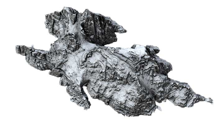
Skellig Michael ('The Rock of St Michael') located off the south-west coast of Ireland is the most spectacularly situated of all the early medieval island monastic sites, with a
well-preserved Monastery and remote Hermitage. The pinnicle consists of two Old Red Sandstone peaks with a valley between them.The island’s isolation has helped to preserve and
protect the monastic remains. There are two main sites on the island: the Monastery and the Hermitage with three flights of steps to the Monastery.
|
Metadata
|
Information
|
|
Source
|
The Discovery Programme |
|
Contacts
|
Mr Anthony Corns
Technology Manager
The Discovery Programme
63
Merrion Square
Dublin
D2
Dublin
Dublin
Ireland
+353 1 639 3039
+353 1 639 3710
info@discoveryprogramme.ie
The Discovery Programme
|
|
Copyright Credit Line
|
Copyright © The National Monuments Service, Ireland (DAHG) |
|
Europeana Rights
|
Free access_no re_use |
|
Spatial
|
Skellig Michael Island
Great Skellig
http://www.logainm.ie/22405.aspx
County Kerry
Ireland
|
|
Protection Type
|
National Monuments in State Care |
|
Start Date
|
400 |
|
End Date
|
800 |
|
Period Name
|
Early Christian Period |
|
Materials
|
Stone |
|
Heritage Asset Type
|
Monastic center |
|
Metadata
|
Information
|
|
Thumbnail
|

|
|
Name
|
Turntable video of untextured 3D model of Skellig Michael Island |
|
Description
|
Turntable video of untextured 3D model of Skellig Michael Island |
|
Type
|
Movie |
|
Format
|
mov |
|
Copyrights
|
Copyright ©The Discovery Programme
Creative Commons - Attribution, Non-Commercial, No Derivatives (BY-NC-ND)
|
|
Link
|
 |
|
Landing Page
|
 |
|
Metadata
|
Information
|
|
Name
|
FLI-Map 400 Lidar Survey |
|
Description
|
FLI-MAP 400; an aerial LiDAR survey system, was initially designed to survey infrastructural assets such as roads, railways and electricity supply networks. The sensor system mounted beneath the main helicopter fuselage consists of:
Three 150 kHz LiDAR sensors (7◦ forward, nadir and 7◦ aft);
Scanning angle 60◦
Accuracy (relative) Horizontal 5 cm, Vertical 3 cm
Multiple returns 4
Two RTK GPS receivers – provide accurate location in used in conjunction with RTK base stations;
Inertial Navigation System (INS)- continuously track the position, orientation, and velocity of the helicopter;
Digital imaging (11 megapixel) and digital video capture.
Resulting data sets include first return (DSM) and last return point (DTM, basre earth) models
|
|
Purpose
|
Remote Sensing |
|
Techinques
|
Lidar survey |
|
Equipment
|
FLI-MAP 400 Lidar system |
|
Actor
|
BKS Fugro, Organisation, Data Capture |