Castle Gate, Derry City Walls (turntable movie)
LDY014:033
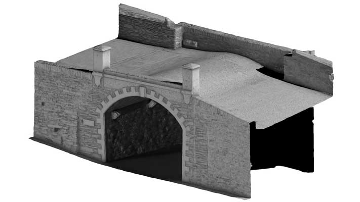
Castle Gate is the smallest and one of the least elaborate of the city’s gates. It was opened through the walls in 1802, and is mainly constructed from uncoursed rubble shale and has a single segmental-arched opening over which the walkway is humped. It is used only for pedestrian access. An old Irish Fortified House of the O’Doherty’s of Inishowen was once located near this site inside the present City Walls.
Derry~Londonderry: A guide to the historic city walls, Northern Ireland Environment Agency
|
Metadata
|
Information
|
|
Source
|
The Discovery Programme |
|
Contacts
|
Mr Anthony Corns
Technology Manager
The Discovery Programme
63
Merrion Square
Dublin
D2
Dublin
Dublin
Ireland
+353 1 639 3039
+353 1 639 3710
info@discoveryprogramme.ie
The Discovery Programme
|
|
Copyright Credit Line
|
Copyright © The Discovery Programme, All Rights Reserved |
|
Europeana Rights
|
Creative Commons - Attribution, Non-Commercial, No Derivatives (BY-NC-ND) |
|
Spatial
|
Castle Gate, Derry
|
|
Protection Type
|
National Monuments in State Care |
|
Start Date
|
1801 |
|
End Date
|
1900 |
|
Period Name
|
19th Century AD |
|
Materials
|
Stone, Rubble |
|
Heritage Asset Type
|
Gateway |
|
Metadata
|
Information
|
|
Thumbnail
|

|
|
Name
|
Turntable video of Castle Gate 3D Model, Derry |
|
Description
|
Turntable video of Castle Gate 3D Model, Derry |
|
Type
|
Movie |
|
Format
|
mov |
|
Copyrights
|
Copyright ©The Discovery Programme
Creative Commons - Attribution, Non-Commercial, No Derivatives (BY-NC-ND)
|
|
Link
|
 |
|
Landing Page
|
 |
|
Metadata
|
Information
|
|
Name
|
Phase-based Terrestrial Laser Scanning |
|
Description
|
Phase based terrestrial laser scanning using a Faro Focus 120 laser scanner.
The instrument quotes the following specification: Distance accuracy up to ±2mm. Range from 0.6m up to 120m. Measurement rate up to 976,000 points/sec. Intensity & RGB. Integrated colour camera. Photorealistic 3D colour scans with up to 70 megapixels. Parallax-free colour overlay. |
|
Purpose
|
Measured survey |
|
Techinques
|
Georeferenced using RTK GPS with VRSnow corrections,Phased based terrestrial laser scanning |
|
Equipment
|
Trimble 5800 RTK GPS,Faro Focus 3D 120 |
|
Actor
|
Gary Devlin, Individual, Geo-surveyor |
|
Actor
|
Robert Shaw, Individual, Senior Geo-surveyor |