Image of the archaeological site of Dromolaxia - Vizakia (Hala Sultan Tekke)
|
|
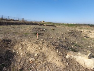
This image shows the archaeological site of Dromolaxia - Vizakia (Hala Sultan Tekke) in Larnaca. More specifically the picture depicts a wooden pole that acts as a mark for the data obtained during the geophysical survey that took place at the excavation site (Building C, Area 8) in January 2014.
| Metadata | Information |
| Source | The Cyprus Institute - STARC |
| Europeana Rights |
|
| Heritage Asset Type | Archaeological area |
| Metadata | Information |
| Thumbnail |

|
| Name | Image of the archaeological site of Dromolaxia - Vizakia (Hala Sultan Tekke) |
| Description | This image shows the archaeological site of Dromolaxia - Vizakia (Hala Sultan Tekke) in Larnaca. More specifically the picture depicts a wooden pole that acts as a mark for the data obtained during the geophysical survey that took place at the excavation site (Building C, Area 8) in January 2014. |
| Type | Image |
| Link |
 |
| Landing Page |
|
| Metadata | Information |
| Name | Photographic campaign, the archaeological site of Dromolaxia - Vizakia (Hala Sultan Tekke), Larnaca |
| Description | Photographic campaign for the documentation of the excavation area of Dromolaxia - Vizakia (Hala Sultan Tekke), Larnaca |