Image of the Santa Cristina archaeological area
|
|
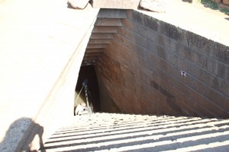
Photo showing the acquisition process of the lower part of the tholos, inside the well with Surphaser 25 HSX hemispherical 3D scanner. This picture was taken during the 3D scanning session of September 2013 in the archaeological area of Santa Cristina.
| Metadata | Information |
| Source | The Cyprus Institute - STARC |
| Europeana Rights |
|
| Heritage Asset Type | Archaeological area |
| Metadata | Information |
| Thumbnail |

|
| Name | Image of the Santa Cristina archaeological area |
| Description | Photo showing the acquisition process of the lower part of the tholos, inside the well with Surphaser 25 HSX hemispherical 3D scanner. This picture was taken during the 3D scanning session of September 2013 in the archaeological area of Santa Cristina. |
| Type | Image |
| Link |
 |
| Landing Page |
|
| Metadata | Information |
| Name | Photographic campaign, Santa Cristina archaeological area |
| Description | Photographic campaign for the documentation of archaeological remains of Santa Cristina archaeological area. |