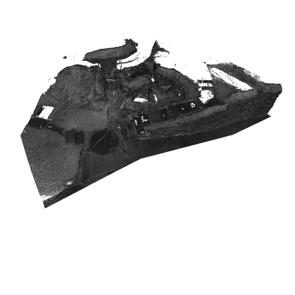
Point Cloud model of House 03, Skara Brae
Subsampled and optimised 3D model of Skara Brae. Greyscale values indicate quality of acquired points.
Skara Brae is an archaeological site with exceptionally well preserved remains that show the stone built furniture and internal structure of ten Neolithic houses and their narrow connecting passageways. Radio Carbon dates show that the village was occupied for around 600 years between 3200 and 2200 BC. There appear to be two main structural phases to the occupation.
House 3 lies on what is now the north-eastern edge of the village. Its northern wall and much of its floor was lost to the sea before the modern sea defences were built. House 3 is one of the later houses at Skara Brae. The original floor area is therefore like to have been around 35 sq meters was so more than half of this house has been lost.
The monument is now managed by Historic Scotland and is a key element of the Heart of Neolithic Orkney World Heritage Site.
|
Metadata
|
Information
|
|
Source
|
CMC |
|
Contacts
|
Paul O Sullivan
CMC Associates
Edinburgh
|
|
Copyright Credit Line
|
CMC Associates |
|
Europeana Rights
|
Free access_no re_use |
|
Spatial
|
Skara Brae
|
|
Start Date
|
3180 BCE |
|
End Date
|
2500 BCE |
|
Period Name
|
Neolithic |
|
Heritage Asset Type
|
Settlement |
|
Metadata
|
Information
|
|
Thumbnail
|
|
|
Name
|
Sampled point cloud of House 03, Skara Brae |
|
Description
|
Subsampled 3D model of House 03, totalling 6 million points. Greyscale values indicate quality of acquired points. |
|
Type
|
3D |
|
Format
|
Stanford PLY |
|
Contacts
|
Andrea D_Andrea
Coordinator
CISA
Palazzina B
8
Vico Santa Maria Agnone
Naples
80139
Italy
Italy
+39081293501
cisa@unior.it
Centro Interdipartimentale di Servizi per Archeologia
|
|
Copyrights
|
CMC Associates
Free access_no re_use
|
|
Landing Page
|
 |
