The Santa Cristina archaeological area, rendered frames
|
|
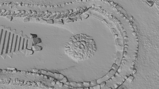
This is a snapshot of a rendered frame taken from 3ds Max software for the purpose of video creation for the archaeological area of Santa Cristina in Sardinia, Italy. The image shows a close up of the upper part of the well (vera di pozzo), the stairs and the tholos from the archaeological site.
| Metadata | Information |
| Source | The Cyprus Institute - STARC |
| Europeana Rights |
|
| Heritage Asset Type | Archaeological area |
| Metadata | Information |
| Thumbnail |

|
| Name | Snapshot of the Santa Cristina archaeological area, rendered frames |
| Description | This is a snapshot of a rendered frame taken from 3ds Max software for the purpose of video creation for the archaeological area of Santa Cristina in Sardinia, Italy. The image shows a close up of the upper part of the well (vera di pozzo), the stairs and the tholos from the archaeological site. |
| Type | Image |
| Link |
 |
| Landing Page |
|
| Metadata | Information |
| Name | Rendered frames post processing |
| Description | Rendered frames related to the video creation of the archaeological area of Santa Cristina in Sardinia, Italy. |