Image of the Santa Cristina archaeological area
|
|
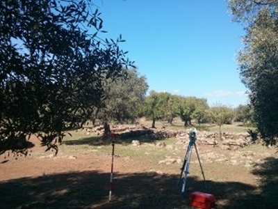
This photo shows the acquisition of the north - east part of the archaeological site. This view is part of the worship area and shows the rectangular areas. The picture was taken in the archaeological area of Santa Cristina during the 3D scanning session of September 2013.
| Metadata | Information |
| Source | The Cyprus Institute - STARC |
| Europeana Rights |
|
| Heritage Asset Type | Archaeological area |
| Metadata | Information |
| Thumbnail |

|
| Name | Image of the Santa Cristina archaeological area |
| Description | This photo shows the acquisition of the north - east part of the archaeological site. This view is part of the worship area and shows the rectangular areas. The picture was taken in the archaeological area of Santa Cristina during the 3D scanning session of September 2013. |
| Type | Image |
| Link |
 |
| Landing Page |
|
| Metadata | Information |
| Name | Photographic campaign, Santa Cristina archaeological area |
| Description | Photographic campaign for the documentation of archaeological remains of Santa Cristina archaeological area. |